
Description
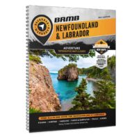
Backroads GPS Maps Newfoundland | Labrador
Backroads GPS Maps Newfoundland | Labradors are the most detailed, comprehensive and up-to-date GPS maps available on the market. These are the maps of choice for recreation, industry, and search-and-rescue, with 3D views, shaded relief and countless geographic and activity based points-of-interest.
Newfoundland & Labrador Backroad GPS Map Features
- Garmin-licensed & compatible with Garmin GPS™, Basecamp™, MapSource™ and RoadTrip™.
- Includes all standard Garmin features such as Find tool, city navigation and more.
- Preloaded 1:20,000 / 1:50,000 base scale seamless topographic maps.
- Provides 3D views and the highest level of map detail available on select Garmin GPS units and Basecamp™.
- The most complete Resource, Industry, and Logging road coverage available for Newfoundland & Labrador.
- Extensive routable road network including City, Resource, and Industry Roads.
- Highlights tens of thousands of kilometres of trail systems, including defined ATV, Paddling, Snowmobile, Long distance & Multi-use trails.
- Features smart background & Searchable Cariboo Management Areas (CMAs) and Moose Management Areas (MMAs) for hunters.
- Includes National, Provincial, Regional, and other Parks & Campsites.
- Extras like Lake & Stream Fishing information with boat launches, paddling access points and more.
- Searchable BRMB descriptions and activity information for fishing, paddling, parks, trails and more.
- Thousands of Searchable cities, Geographic Land, and Water features
- Features Address searching to aid navigation.
- Industry leading cartographic contours and shaded relief for all of Newfoundland and Labrador.
KENNETH MCFARLANE (verified owner) –